
We left the Dawson Creek parking lot at six-thirty in the morning, too early for Wal-mart to be open. Dawson Creek is the very beginning of the Alaskan Highway, constructed in 1942. Very discouraging to have made It this far only to be told that the real adventure was really only beginning. We filled up our tanks at 1.37 per liter before continuing northbound. We came to a roundabout and followed the famous arrow to Alaska. As we left, the fields planted with bright yellow canola waved us goodbye and good luck.


Back in ’42, the threat of Japanese invasion started the construction of a road connecting Alaska, via Canada, to the rest of the United States. It was constructed in only eight months, as Pearl Harbor, the invasion of Attu and Kiska in the Aleutian Islands, and the imminent danger of further invasions, made this military installation a top priority. It didn’t open to the public until ’48 but it quickly gained the reputation of a tough terrain to traverse.


Back in ’42, the threat of Japanese invasion started the
construction of a road connecting Alaska, via Canada, to the rest of the United
States. It was constructed in only eight
months, as Pearl Harbor, the invasion of Attu and Kiska in the Aleutian
Islands, and the imminent danger of further invasions, made this military
installation a top priority.
 It didn't open to the public until ’48 but it quickly gained the reputation of a tough
terrain to traverse. Today, the road is entirely
paved, not counting the constant construction for maintenance. The Alaska Highway begins in Dawson Creek and
ends in Delta Junction, AK. We would be
leaving the Alaska Highway in Whitehorse, YT taking the Klondike Loop into
Dawson City, YT. Then, we’d be taking
the Top of the World Highway, on our tenth wedding anniversary,
across the Canadian-Alaska border.
It didn't open to the public until ’48 but it quickly gained the reputation of a tough
terrain to traverse. Today, the road is entirely
paved, not counting the constant construction for maintenance. The Alaska Highway begins in Dawson Creek and
ends in Delta Junction, AK. We would be
leaving the Alaska Highway in Whitehorse, YT taking the Klondike Loop into
Dawson City, YT. Then, we’d be taking
the Top of the World Highway, on our tenth wedding anniversary,
across the Canadian-Alaska border. 
Before twenty miles were behind us, we took a side road, the
original Alaskan Highway, to the Kiskatinaw River Bridge. This 531 foot original timber bridge is the
only one still in use today. We pulled
over for a bite of breakfast. While
Jason was eating in the camper, Catrina spotted a deer. While she scrambled for the camera, located
in her pocket, a fox trotted out of the woods within just a few feet. She, unfortunately didn’t catch either for
posterity.


We didn’t stop again until Fort Nelson, located at historic
mile marker 300, where we re-filled and showered. Jason had used the rest of the water in our
tank that morning, but we forgot to re-fill it there or anywhere at that point. The first three hundred miles has stayed
mostly straight, flat across the prairie.


We passed a herd of animals, near McDonald Creek, that we
are for certain were Stone sheep, this time, as mountain goats are not seen in
this particular region. We’re still
unsure how to tell the difference between mountain goats, Dall sheep, and Stone
Sheep. Not sure if the herds we saw the
day before were mountain goats or if they were stone sheep, or Dall sheep,
even. In the winter, goats have longer
hair so it’s much easier to tell the difference then. Mountain Goats are supposed to have darker
horns, and when reviewing the pictures of the second herd, the horns do not appear
dark enough to be goats. Then, there
seems to be some argument if the darker Stone Sheep are even a different
species from Dall Sheep. So confusing, but we saw some animals, even if we
weren’t certain of their correct species.


At 3:10, we were stopped for construction for close to an
hour. We had a nice conversation with
the couple in the RV ahead of us. We had
passed them, and they had passed us.
They were easy to spot with two large bumper stickers on the back. The bumper sticker labelled the left side as
a passing side, while the bumper sticker on the right labelled that side as
suicide. Jason didn’t think it was
funny. But, they were a friendly couple
going the same direction as us, and he had once went to a University in Texas,
not far from where we reside. They, too,
were going to Alaska for fishing, but they had hired a guide. Soon enough, we were all on the move again,
waving goodbye to our new acquaintances.


We passed Summit Pass with little notice. This would be the highest point, at 4,250
feet, we would reach while on the Alaska Highway.


At 4:08, we crossed the Racing River Bridge, a seventeen
foot clearance girder bridge with metal grating instead of pavement. The Racing
River forms the boundary between the Sentinel Range and the Stone Range.


Toad River, a beautiful aqua color, weaved around the forest
beside the road for a little bit, until we eventually crossed over the Toad
River Bridge.


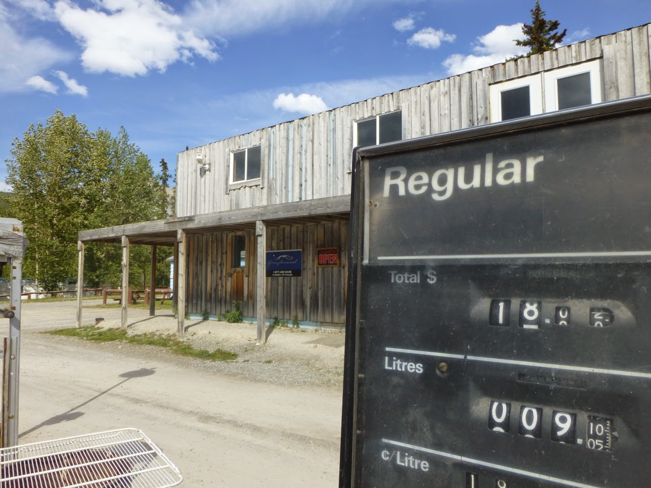
We stopped at a little picturesque gas station in the town of
Muncho Lake, adding just a few liters at 1.58/liter to reinsure that we made it
to the next station.


Muncho Lake, one of the largest natural lakes in the Canadian Rockies,
is seven and half miles long and one mile wide. Reports claim the deepest point
to be seven hundred thirty feet deep, but the confirmed depth is no deeper than
four hundred feet. The brilliant colors are attributed to leaching copper
oxide. In the east, the Sentinel Range
drains into the lake. In the west, the
Terminal Range drains into the lake. The
mountains surrounding the lake are approximately seven thousand feet. The island in the middle is named Honeymoon
Island.


At about 4:00, we came across two young caribou trotting
along the highway. While licking the salty
pavement, they rubbed their velvety antlers together, before trotting a little
further.


Thirty minutes later, we drove into a herd of bison grazing
on either side of the road.


At about 5:00, we stopped at Liard Hot Springs, the second
largest hot springs in Canada. We popped
up the camper and changed into our bathing suits, in anticipation of the swim
in the spring. It was warm here, and the
mosquitos were beginning to swarm and bite.
We covered ourselves in bug spray, before walking toward the boardwalk
to the springs. The mosquitoes were
starting to swarm and had filled the camper when we popped the peak.

The original boardwalk and pool facilities had been built by
the United States Army in 1942, but the park hadn't been designated until 1957. The boardwalk protects the delicate muskeg
that forms the warm water swamp, filled with, at least, fourteen different
species of orchids alone.


Jason remembered two springs, an Alpha pool and a Beta
pool. The Alpha pool reaches up to one
hundred and twenty six degrees Fahrenheit.
However, Beta pool had been closed.
The boardwalk had been removed and there was little trace of the pool
being harmed by humans.


Before we got in the pool, we walked to the hanging garden,
overlooking the pool. Strangers’ eyes
stared as we walked up the boardwalk, past the Alpha pool. As many people that
were in the pool, there was no one on the boardwalk to the falls.


We walked back to Alpha pool, and set our towels and shoes
on the bench. We walked into the warm
sulpher water. The water was a lot
hotter than our body temperatures, and the upper seventy degree weather outside
made the pool a little uncomfortable, temperature wise. We were very buoyant, and had trouble walking
around, or sitting on the provided benches in the water. Jason had us walk as close to the spring as
possible, the water getting warmer the further we went toward the water
source. After a few minutes, we decided
it was time to get out of the water.


We changed our clothes quickly, as we had spent quite a bit
of time here. On the way out, we
remembered to re-fill the water tank. As
I was standing there, observing the hose fill the side of the camper, Jason
walked to the ranger station to ask about the closed pool. People had endangered the habitat of a rare
snail, so they had closed that particular spring to the public.


Later, when Catrina went to research the Banff snail, she
learned about a publicized rare deadly black bear attack in ’97 that had
occurred near the hanging garden. Probably at the exact spot that the railing
and boardwalk had been replaced. No
wonder there hadn’t been anyone that went that direction on the boardwalk. Some claimed that this was the real reason
the pool had been closed, but Catrina also found the research proving that just
a little human interaction could cause the death of thousands of these rare
snails.


Upon leaving the park, we quickly spotted two black bears
playing the ditch. They were grazing on
the grass. Soon, like New Mexico and
antelopes, we were pointing out the black bears. The trees on either side of the road had all
the bark stripped, making it obvious that this area was over-populated with
bears.


Among the many black bears, we also caught a glimpse of our
first brown bears. A mama bear with two
cubs grazed also in the right-of-way.


We stopped at a roadside park, snapping pictures of a
memorial to the construction workers of the Alaska Highway.


We passed through Watson Lake, filling up for 1.47/liter. Watson Lake, itself, is not visible from the
highway, but it isn’t the most publicized attraction, anyway. It was just after eleven o’clock, yet the sun
was still above the horizon. Most gas
stations were closed, but the pumps were still on. The streets felt strangely deserted, empty,
while daylight, except for a few teenagers up to the assumed no good. Everyone else were home in their beds.


We stopped at the Signpost Forest. Poppies grew amongst the signs. The “Forest” was empty, and we took a quick
stroll through a few of the markers, noting dates. The oldest signpost we saw marked with a date
was ’67. Originally, a homesick Carl K.
Lindley had posted a sign marking the distance to home, Danville, IL, while
working on the highway in ’42. Travelers
started adding to add their own signs, and last counted at more than 75,000
signs. Neither Jason nor Catrina were
volunteering to count them all.

We got back on the road, and drover a little ways out of
town. We found a pull-off by the Lliard
River for the night. We popped the
camper, and put a pre-made lasagna in the oven.
The problem with the pop-up A-frame camper is the inability to put it up
and keep every mosquito out. And as we
fell asleep by the river, in the daylight, we were bitten by what felt like a
million mosquitoes, but a decent rest was had by all.

No comments:
Post a Comment